
價格:免費
更新日期:2018-02-17
檔案大小:5.9 MB
目前版本:2.0.2
版本需求:需要 iOS 9.0 或以上版本。與 iPhone、iPad 及 iPod touch 相容。
支援語言:英語
Have you ever wondered if the café you were sitting in was in turn sitting on the Osceola Mudflow?
Do you want to map out your tsunami evacuation route for an upcoming trip to the coast?
Have you reached the job site in Seattle and forgotten critical boring log data?
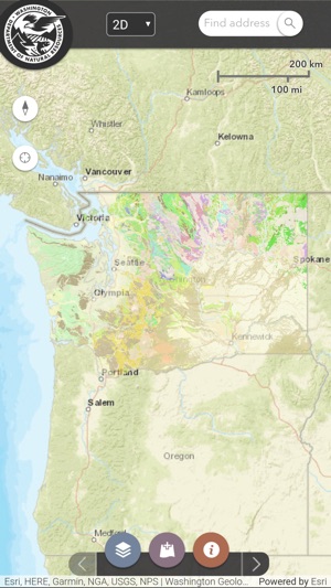
Now you can explore Washington’s geology, learn about geologic hazards, and find borehole lithology data all from your mobile device.
This app is a much-simplified beta version of the Washington Geologic Information Portal, a desktop-based interactive map containing detailed and comprehensive geologic data about Washington State. This app is ideal for geology students, professionals, and those familiar with geologic terms and concepts.
Available Layers:
Surface Geology at 1:500,000, 1:100,000, and 1:24,000 scales and geochronology data
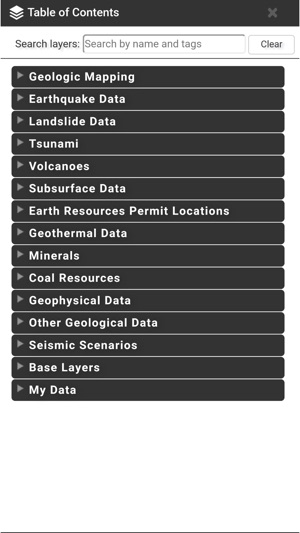
Tsunami Evacuation: including: assembly areas, local landmarks, evacuation zones, and map boundaries
Subsurface Data: geotechnical borings and water wells
Faults, Earthquakes, and Tsunamis: active faults and folds, trenches, earthquakes, liquefaction susceptibility, seismic site class, and tsunami inundation modeling
Note:
This app requires an internet connection to display data, and data charges may apply. Geolocation services are enabled in order to display device location on the map, but the data is not collected or saved.
Desktop version: http://www.dnr.wa.gov/geologyportal
Visit our website: http://www.dnr.wa.gov/geology
Or our blog: https://washingtonstategeology.wordpress.com/
支援平台:iPhone, iPad